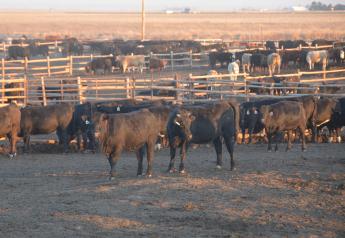
Some Drought Improvement in Midwest

This week's National Drought Monitor reflects a "significant storm system" that came through the region at the end of the current U.S. Drought Monitor period, covering much of Missouri, Illinois, Iowa and portions of southern Wisconsin and Indiana with a long and slow rain event. "This event was important to the region as most of the harvest has been completed and dry soils were in need of recharge going into winter," states the monitor.
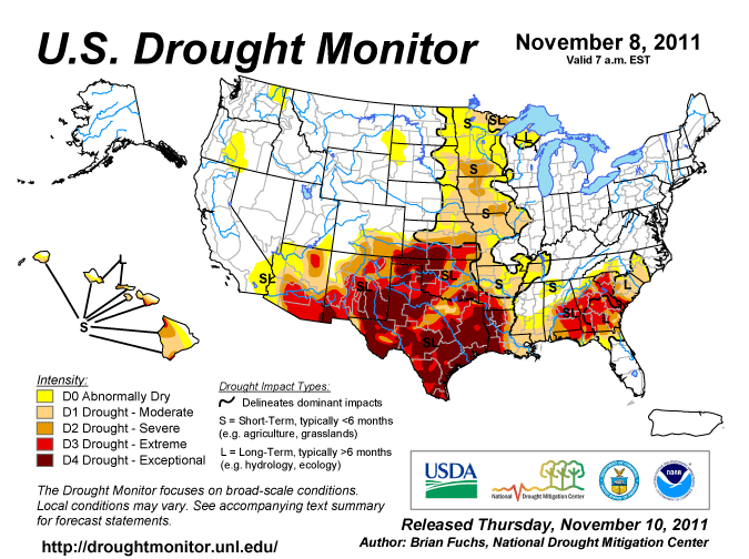
For some areas of Iowa, Illinois and Missouri, this was the first significant rain in the last several months. Some areas did see rain after the cut-off for inclusion into this current U.S. Drought Monitor and may need to be assessed further in the coming weeks for potential improvements due to the rain. "With this event, D2 conditions were brought out of Illinois, shifting them to the west where D2 was also improved in Iowa and Missouri. D2 was also improved in southwest and central Missouri as some of these areas had well over 3 inches of rain this week," states the monitor.
Portions of Kansas and Nebraska were impacted by the same storm system that brought substantial rains to the Midwest. "As in the Midwest, it was raining at the end of the current U.S. Drought Monitor period and full response to the local drought status was not yet determined. It was determined that analyzing the data in the coming weeks when the full impact is known was the most favorable solution. With that, status quo was maintained for Nebraska this week and the only change made in Kansas was to coordinate improvements along bordering states. In the northern Plains, D0 was expanded in the area north of the Black Hills region of South Dakota while D0 was expanded to the west along the South Dakota and Nebraska borders," it states.
Over the next five days (November 9-13), temperatures are expected to be above normal east of the Rocky Mountains and close to normal in the southeastern United States. "In the central Plains, high temperatures should be 6-9 degrees Fahrenheit above normal; in the western United States, high temperatures will be about 3 degrees Fahrenheit above normal," states the outlook. "As a trough works into the Great Basin, there is a good chance of precipitation, with the greatest amounts over the southwest, the California coast and the Pacific Northwest. As a strong low moves into the Great Lakes, associated precipitation will bring more than an inch of precipitation to many locations in the region."
The CPC 6-10 day forecast (November 14-18) continues to show the influence of a trough over the western U.S. as well as over the Great Lakes. Precipitation chances look to be best over Alaska, the Great Basin, and the Great Lakes while the regions with the best chances for below normal precipitation are in Texas and Florida. Temperatures are projected to be below normal over Alaska and the western United States and the best chances for above normal temperatures will be over the east coast.