Martell: Shift in South American Weather Pattern

The following content was provided by meteorologist Gail Martell of MartellCropProjections.com:
Shift in South American Weather Pattern
Very dry soybean farms in Mato Grosso are expecting generous rainfall this week while Buenos Aires in southern Argentina is expecting sunshine and warmth and opposite of December. Soybean prospects are expected to improve in Brazil’s leading soy state, though damage to short-cycle soybeans has been inflicted. In Buenos Aires, Argentina, record setting heavy rain not only reduced the area of corn planted, but also caused stunting from repeated flooding and reduced fertility from fertilizers leaching out of the root zone. The USDA December estimate for record Argentina corn production in 2012-13, 27.5 million metric tons, is unrealistic. Even a normal corn harvest is out of the question. Whenever a weather record is broken, there is a severe penalty to pay in crop production.

Historic Dryness in Top Brazil Soybean State
December growing conditions were the driest since 1979 in Mato Grosso, Brazil’s top soybean state, in the key central soybean producing areas. Goias was also exceptionally dry along with Bahia and Minas Gerais from widespread drought in the tropics. December growing conditions were exceptionally wet in Rio Grande do Sul in the south of Brazil. Up to half of Brazil soybeans were adversely affected by extreme weather. At the same time, Buenos Aires Argentina’s top corn province experienced record wetness in December, stalling planting and flooding farms.

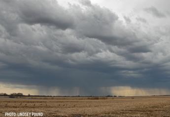
Welcome Rain Coming to Southern Great Plains
Drought stressed areas of Texas and Oklahoma are expecting heavy rainfall this week that would improve field moisture for winter wheat development and cattle grazing. By Wednesday morning, a broad trough of low pressure would develop across the Southern Great Plains. West Texas is expecting .50 – 1 inch of rainfall, and Oklahoma .75-1.50 inches. Southern Kansas would be relatively drier with expected rainfall from .15 to .55 inch. Any moisture is beneficial in the wake of historic summer-fall drought.

The subtropical jet stream has grown suddenly active delivering waves of showers to drought-stressed farms in the southern Great Plains. Last week, southwest Kansas received 2.5 inches of snowmelt from a different storm.
Rapid Midwest Snowmelt with Strong Warming
Unseasonable warmth is coming to the United States this week, reversing the pattern of severe winter cold in December. Temperatures are expected to be 10-12 F above normal in the eastern two-thirds of the nation.

Moderate-heavy rain is predicted along with strongly warming temperatures. Rapid melting along with generous rainfall would encourage widespread run-off into ditches and steams. Iowa farms still have a 5-inch moisture deficit from prolonged and intense summer and fall drought. Minnesota has a 6 inch moisture deficit, and Nebraska, 6.8 inches, in the long period back to mid July. A slow and orderly snowmelt would be ideal for increased penetration into dry fields.
Southern Prairie Drought in Canada
The United States is the not the only area with reduced soil moisture. Southern Saskatchewan and southwest Manitoba also are dry with only 40-60% of normal precipitation over the past 6 months. Drought is relatively less severe in the central prairies, where most spring wheat and canola is produced, with 60-85% of average moisture in the long period back to July, 2012. An enormous ridge of high pressure is building into Western Canada that would keep conditions dry this week. Temperatures have just begun warming up in the western prairies. Weekend temperatures rose into the upper 20s F to low 30s F, a veritable " heat wave" following a bitterly cold December.