Picture Perfect

 Almost everyone has a digital camera or a cell phone with a camera, and these can be useful tools for monitoring forage in pastures.
Monitoring rangeland is important because it improves your ability to make proper decisions. Rangelands are complex. Any given pasture may be composed of several different range sites, each with different plant communities.
Farmers and ranchers can use their cameras to monitor rangelands to make sure management strategies are not causing damage to soil, water quality or the range resource base. Also, you can see if past management decisions are yielding expected results.
Select photo points to monitor. Select sites where photos will be taken at least once a year. Fall to early winter is the best time for photographs taken annually. For seasonal monitoring, you may want to take photographs in late winter or spring green-up, midsummer and at frost, before and after grazing a pasture or when controlling brush.
Monitor sites that support different plant types. An individual pasture may have multiple range sites. These range sites can be identified using county soil survey manuals or with the help of an Extension agent or Natural Resources Conservation Service personnel.
Photo points for monitoring grazing should not be situated close to water or in the back of the pasture. Select sites that represent the range site in general and the use it receives by grazing animals.
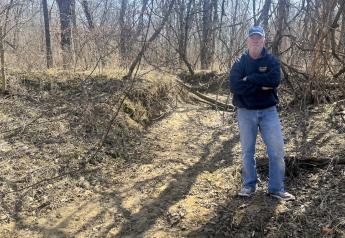
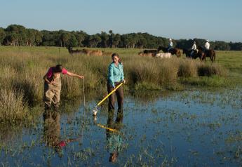
When taking photos, shoot from a near vertical position of the same few square feet of ground over time to show details of the soil, litter and vegetation.
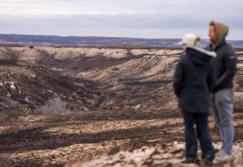
Taking scene photographs will show a much larger landscape view of the brush, grass, terrain and soil in the pasture. Photograph the scene with the bottom of the photo no further than 10' away, so the foreground can provide details of changes in herbaceous species, cover, litter, bare ground, etc.
Permanently mark photo sites. Drive a steel fence post into the ground, stretch a 100' to 300' tape from the post in a north or south direction, and drive a second fence post at the end of the tape to mark the site.
The fence posts serve as the benchmarks for the two scene photographs taken each year. One scene photograph is taken from the south post, looking back at the north post. The second photo is taken from the north post, looking back at the south post. Set up three to five photo plots per location.
Once you select a location for close-up photos, use a photo frame (make your own using two 6' folding carpenter rulers or PVC pipe to form a square) to permanently mark the location. Drive 1' sections of rebar rods into the soil at two opposite plot corners so you photograph the same exact location year after year.
Place a sign next to the plot frame to identify the date, pasture and the distance the plot frame is located along the tape. Take the picture by standing as close to the plot frame as possible while still including the plot frame and the identification sign in the picture.
Allan McGinty is a Texas AgriLife Extension range specialist in San Angelo, Texas.