Drone Applications on the Ranch

Unmanned Aircraft Systems (UAS), more commonly known as drones, have become increasingly common throughout society. Drones are not new to the agricultural world and have been employed primarily in the crop sector for several years. These have primarily been relatively expensive, specialized units that were of limited utility outside of the crop fields. As the technology has evolved, costs have come down and the accessibility and utility of drones outside of the crop sector has improved. While drones cannot and should not replace in-the-field work and observation, they have a lot of potential for applications on the ranch in a variety of areas. In this article we will explore some of the ways drones might be used on a ranch to improve management and operations.
Rangeland Monitoring
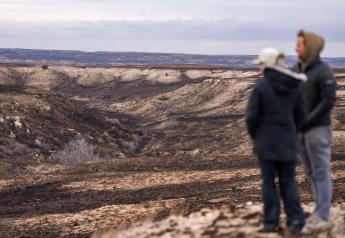
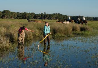
Using a drone as part of a rangeland monitoring program will open up a new perspective that is not visible from the ground level. Many consumer drones can be used to take photo points, repeated pictures from the same location that visually track changes over time. Additionally, some flight software allows the user to send the drone on a preprogrammed path, which could be used to create photo transects of a larger area. While detailed ground-level data is still very important, a drone opens up the possibility of collecting more data with much less labor. One limitation of ground-level data is that it is just that – ground level. A drone can offer a perspective from 10 feet, 50 feet, 100 feet, or more, providing useful insights into different trends than can be seen from the <6 foot view when only conducting monitoring on foot.
Aerial maps are a valuable tool for planning grazing, crop rotations, infrastructure development, and more. Maps from satellite imagery are helpful, but are often limited by poor resolution, cloud cover, and out of date imagery. A drone can be used to create a more up to date, high resolution map of a ranch using a combination of flight planning software and photogrammetry software that combines many overlapping photos into one georeferenced map. These maps may take several flights depending on the area covered, the type of drone used, and the resolution desired.
Animal Monitoring
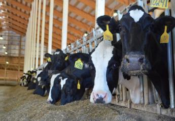
Drones also have potential to be useful for monitoring and managing livestock on the ranch. An overhead view can greatly simplify head counts on cows and calves, for instance, over trying to count multiple classes of livestock as they are milling around in the pasture. Some drones can be outfitted with near-infrared cameras that detect heat, which can be used to locate strays or find animals in heavy cover or rough terrain. A preprogrammed flight path could be used to check remote water sources or fencelines, potentially saving hours of labor and wear and tear on a pickup. Drones can be used to check calving pastures, potentially with less disturbance to the livestock.
New technologies are being developed that allow producers to monitor individual animals with a drone. A radio frequency ID (RFID, aka microchip) reader can log unique tag numbers and alert the user if a particular animal was not detected. Some types of tags can even monitor temperature and behavior parameters to help identify health issues with an animal. Of course this technology should only be used to supplement, not replace, old fashioned observation and sound animal husbandry.
Conclusion and Caveats
Drones are a relatively new technology, and even more so within the ranching world; we have only begun to scratch the surface of what is possible with a drone. What was once considered a toy is proving to have real, useful applications in the day to day operations and management of a ranch. As labor supplies seem to be constantly dwindling, and the to-do list just keeps getting longer, producers are encouraged to consider whether a drone might be a valuable addition to help streamline their operation. This article is only meant to provide a brief overview of some of the possibilities of a drone. Future articles will explore some of these uses in further detail.
Although there is tremendous potential for drone applications on the ranch, people also need to be careful not to place too much stock in one tool. It is important to remember that the drone is just one tool in the toolbox, and is not a cure-all for everything. A drone can supplement data collected for ranch management, and can reduce labor requirements for some tasks, but that is only one piece of the puzzle. You still need to be out in the pasture and among your livestock to truly have a comprehensive picture of everything that is going on. It is important to think carefully about what information the drone is providing, how that will be used, and what it is not providing; this planning will allow successful integration of a drone as a useful tool on the ranch and hopefully prevent frustration.
Finally, it is important to be aware of the legal requirements to operate a drone. In general, most hobby and recreational applications of a drone don’t require a license and can be operated under the Special Rule for Model Aircrafts (Section 336). Commercial use requires a Remote Pilot Certificate under the Small UAS Rule (Part 107). This is beyond the scope of this article, but details regarding licensing, operating rules, flight restrictions, and more can be found on the Federal Aviation Administration’s Unmanned Aircraft Systems website at https://www.faa.gov/uas It is the operator’s responsibility to ensure they are complying with all laws governing drone use in their location and for their purposes.